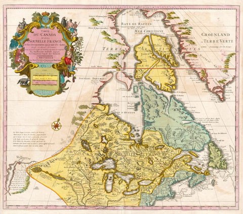
Canada & the Great Lakes, 1730 Covens & Mortier
Description:
SHIPPING IS NOT INCLUDED - Please contact for a quote.
ORIGINAL ANTIQUE MAP
"Carte du Canada ou de la Nouvelle France, & des Découvertes qui y ont Été Faites"
Mapmaker / Publisher: Delisle /Covens & Mortier
Date: 1730
Size: 25" x 21"
This richly detailed map provides the most accurate rendering of the Great Lakes of the time, with the lakes fully enclosed and properly placed in longitude and latitude. Delisle’s map of Canada and the Great Lakes is one of the most outstanding and influential maps of the 18th century.
Certificate of Authenticity is provided.
We think you may also like...
-
 $2,100.00