Description:
REPRODUCTION
North America
Mapmaker / Publisher: Tallis, John
Date: c.1851
Size: 13.5" x 17.5"
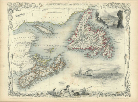
A very decorative map of North America surrounded with the vignettes that were drawn by J. Marchant and engraved by J.Rogers. The map is filled with forts and locates many Indian tribes. Texas is shown in a curious configuration without a panhandle, Western Territory takes up much of present-day Kansas and Oklahoma, and New Mexico is shown as a tiny strip of land above Texas. The vignettes include an Ancient Monument in Mexico, Convoy of Diamonds, Falls of Niagara, Beavers, Elk, and North American Indians. Across the top are Russian Cossacks (representing the Russian Possessions in Alaska), an Eskimo dog sled and Mount Hekla, Iceland. The map was drawn and engraved by John Rapkin.
We think you may also like...
-
 $2,100.00