2801 Carte de la Nouvelle France, 1718, Châtelain
Description:
REPRODUCTION
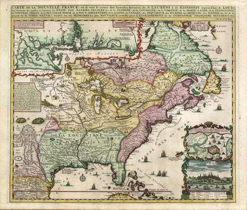
Carte de la Nouvelle France, où se voit le cours des Grandes Rivieres de S.Laurence & de Mississippi.
Mapmaker / Publisher: Châtelain, Henri Abraham
Date: 1718
Size: 25" x 22"
Detailed map of eastern North America, designed to show the courses of the St. Laurence and the Mississippi, produced during the ‘Mississippi Bubble.’ One inset charts the mouth of the Mississippi, the other a prospect and map of the environs of Quebec. Although the cartography is based on the rare four-sheet map by De Fer, the vignettes scattered over the surface come from De Bry.
We think you may also like...
-
 $2,100.00