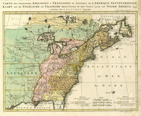
2492/1 Eastern Canada and Eastern US, 1755, Ottens
Description:
REPRODUCTION
Carte des Possessions Angloises & Francoises du Continent de l´Amerique Septentrionale
Mapmaker / Publisher: Ottens, Reiner u. Josua
Date: 1755
Size: 25" x 21"
A Dutch version of Jean Palairet´s important map showing the French and English territorial claims on the eve of the French and Indian War. The map is filled with details of towns, forts, roads, and the tribal lands. Title and notations are in both French and Dutch. Beautiful original colour delineating the French and British colonies and those islands in dispute between the two powers.
We think you may also like...
-
 $2,100.00