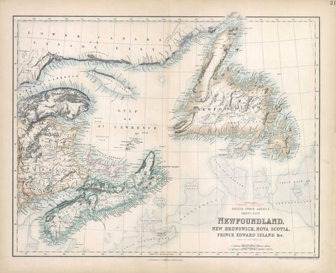
G2647 British North America, Sheet 1. East, 1874, Fullarton
Description:
REPRODUCTION
British North America, Sheet 1. East
Mapmaker / Publisher: Fullarton, Archibald
Date: 1874
Size: 27" x 22.5"
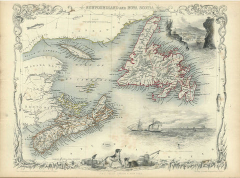
Folio map of British North America Sheet I. East: Newfoundland, New Brunswick, Nova Scotia, Prince Edward Island & c. from “The Royal Illustrated Atlas of Modern Geography.”
We think you may also like...
-
 $2,100.00