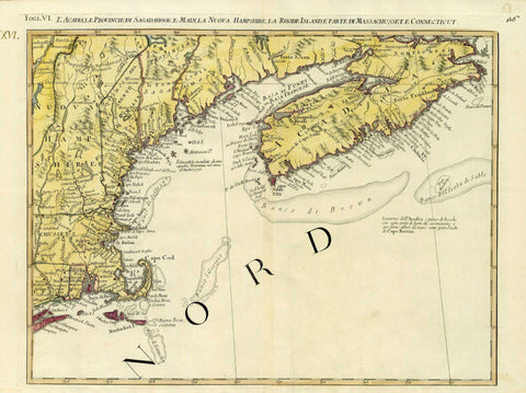
3130 Nova Scotia to Cape Cod, 1778, Zatta
Description:
REPRODUCTION
L´Acadia, Le Provincie di Sagadahook e Main, La Nuova Hampshire, La Rhode Island, e Part di Massachusset Connecticut
Mapmaker / Publisher: Zatta, Antonio
Date: 1778
Size: 18.5" x 14"
A beautifully colored map showing Acadia (Nova Scotia) to the western border of New Hampshire, extending south to include Cape Cod, Nantucket, Rhode Island, and the east of Massachusetts and Connecticut. Zatta’s map was based off an earlier map by Mitchell, though it includes a number of geographical changes. Published in Raynal’s “History of North America.”
We think you may also like...
-
 $2,100.00