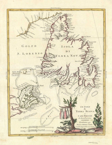
2514 Map of Newfoundland, 1778, Zatta
Description:
REPRODUCTION
LE ISOLE DI TERRA NUOVA E CAPO BRETON
Mapmaker / Publisher: Zatta, Antonio
Date: 1778
Size: 15" x 19"
A map of Newfoundland, the Gulf of St. Lawrence and parts of Cape Breton Island. Includes a beautiful coloured cartouche depicting local plants and fish drying, illustrating the importance of the fishing industry to this area. Published in Venice.
We think you may also like...
-
 $2,100.00