Description:
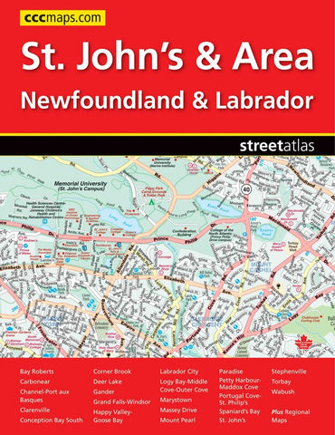
It’s the definitive auto companion for travel in this area, whether you are a resident or short-term visitor. It’s got all the features to make even the unfamiliar areas easy to navigate. Inside this 88 page atlas you will find detailed city maps of Bay Roberts, Carbonear, Channel-Port aux Basques, Clarenville, Conception Bay South, Corner Brook, Deer Lake, Gander, Grand Falls-Windsor, Happy Valley-Goose Bay, Labrador City, Logy Bay-Middle Cove-Outer Cove, Marystown, Massey Drive, Mount Pearl, Paradise, Petty Harbour-Maddox Cove, Portugal Cove-St. Philip’s, Spaniard’s Bay, St. John’s, Stephenville, Torbay and Wabush at a scale of 1:20,000, a downtown St. John’s map (1:12,500), a St. John’s and Area map at 1:50,000, a regional map of Labrador (1:3,333,333) and a regional map of Newfoundland (1:800,000).
Updated edition 2011
We think you may also like...
-
 $14.95