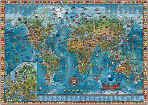
Amazing World Children's Laminated Wall Map 54"x 39"
Description:
The Amazing World Illustrated Map is a geographic map decorated with 650 unique illustrations representing animals, monuments, transportation, national curiosities and natural sites. These illustrations are also listed in an index. Europe is displayed in an inset at a better scale. All political and geographical information is current and accurate. The map is in English and serves for education and also for decoration. Ships rolled in a soft plastic sleeve.
The size is 54"x39", printed on paper with gloss coating.