Description:
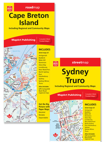
The Cape Breton Island / Sydney Truro folded map includes a detailed regional road map of Cape Breton Island at 1:275,000, city maps at a scale of 1:25,000 of Antigonish, Baddeck, Bible Hill, Dominion, Glace Bay, Louisbourg, New Waterford, North Sydney, Port Hawkesbury, Sydney, Sydney Mines and Truro. Indexes, distance chart and legends for the regional map and city maps are handy references.
The detailed city mapping has many features such as Trans-Canada Highway, divided highways, major roads, secondary roads, main thoroughfares, minor streets, lanes / private streets, one way streets, interchange numbers, railway / VIA Station, ferries, municipal boundaries, recreation trails, parks / conservation areas, golf courses, commercial areas, cemeteries, institutional areas, industrial areas, special attraction areas, Indian Reserves, National Defence, hospitals, tourist information canters, police stations, fire halls, municipal / regional buildings, courthouses, libraries, points of interest, off leash dog parks, liquor stores, marinas / yacht clubs, national parks / historic sites, arenas, pools, baseball, soccer, tennis, public schools.
Updated edition 2023
We think you may also like...
-
 $7.95
$7.95 -
 $19.95
 -
 $6.95
$6.95 -
 $29.95


