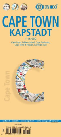
Cape Town Borch Map
Description:
Folded laminated street map * Scale 1:15,000 * Legend includes sights, museums, monuments, churches, synagogues, mosques, shipwrecks, windmills, cable railway, beaches, caves, windsurfing sites, scuba diving, police stations, hospitals, golf courses, bus stations, parking, airports, airfields, commuter train, waterfalls, camping sites, viewpoints, national parks, nature reserves, hotels, shopping centers, markets * Includes inset map of Robben Eiland 1:40,000, Cape Peninsula 1:140,000, Cape Town & region 1:635,000, Garden Route 1:3,000,000, metro-rail system * Climate charts show the average daily temperatures, humidity, hours of sunshine and precipitation for each month.
Updated edition 2018