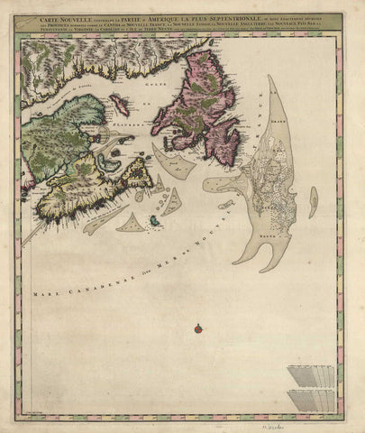
G3095 Eastern Canada, 1680, Visscher
Description:
REPRODUCTION
Carte Nouvelle Contenant la Partie D’Amerique la Plus Septentrionale
Mapmaker / Publisher: Visscher, Nicolas
Date: c.1680
Size: 22" x 26"
A finely engraved copperplate map of Maritime Canada with Newfoundland, depicting the major fishing grounds locations. The Visscher family were prominent Dutch map publishers in the 17th century.