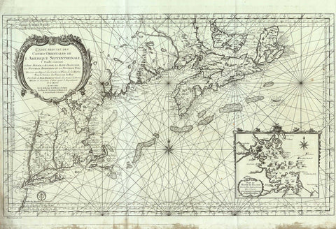
2800 Eastern Coast of North America, 1757, Bellin
Description:
REPRODUCTION
Carte Réduite Des Costes Orientales de L’Amerique Septentrionale I.re Fueille contenant L’Isle Royale, L’Accadie, La Baye Françoise, La Nouvelle Angleterre et la Nouvelle Yorc.
Mapmaker / Publisher: Bellin, Jacques-Nicolas
Date: 1757
Size: 37.5" x 26"
Large and detailed chart of the Eastern Seaboard from New York north to Cape Breton and Prince Edward Island. Includes an inset of Boston Harbour.