3539 Chart of the Coast of America, 1674, Seller
Description:
REPRODUCTION
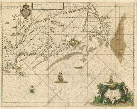
A Chart Of The Coast Of America From New Found Land To Cape Cod
Mapmaker / Publisher: Seller, John
Date: c.1674
Size: 27" x 22"
Published in Seller’s Atlas Maritimus, the earliest general marine atlas produced in England, this was the first English chart of New England waters. It clearly shows the northern navigation routes with soundings, as well as the islands and lucrative fishing banks off the coasts of Nova Scotia and Newfoundland. Boston and Charlestown are also located and named.