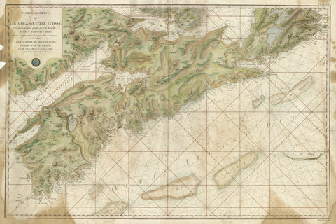
3411 Nova Scotia, 1779, de Sartine
Description:
REPRODUCTION
Carte Reduite de l'Acadie ou Nouvelle Ecosse
Mapmaker / Publisher: Dressee au Depot General des Cartes by order of M. de Sartine
Date: 1779
Size: 39" x 27"
A large and detailed chart of Nova Scotia, with the southern parts of Cape Breton Island and Prince Edward Island. Unusually for a sea chart the interior is hatchured to show relief. The map was published at the height of the American War of Independence.