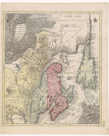
2310/1 Central and Eastern Canada, 1760, Lotter
Description:
REPRODUCTION
Partie Orientale de la Nouvelle France ou du Canada
Mapmaker / Publisher: Lotter, Conrad Tobias
Date: c.1760
Size: 23" x 26"
One of the first general maps to show the newly founded Halifax was this rather distorted but nevertheless fascinating map, drawn by Tobias Lotter and engraved by Matthias Seutter, published in Augsburg sometime after 1750. Needless to say, the map is famous for its artistic appeal rather than for its accuracy. Lake Ontario is placed near the Atlantic. The ‘squashed’ appearance of the map has been jokingly referred to as the "Lotter projection".