Description:
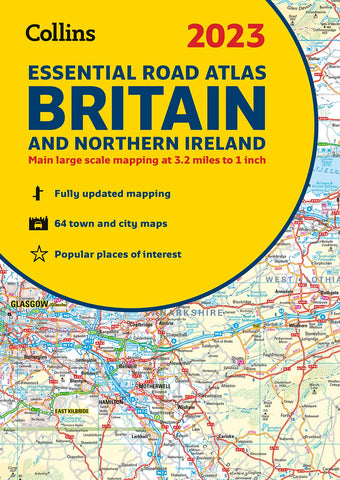
A new 2023 A4 road atlas with lie-flat spiral binding features clear, detailed road mapping, at a scale of 3.2 miles to 1 inch for England, Wales and Southern Scotland and at 4.2 miles to 1 inch in Northern Scotland, with land height shown by attractive layer colouring.
• Route planning section including maps at a scale of 22 miles to 1 inch, motorway services information and a handy distance calculator chart.
• 26 urban area maps at a larger scale which clearly show the best routes through and into the busiest built-up-areas.
• 64 street maps focused on town centers showing places of interest, car park locations and one-way streets. All the street maps are fully indexed.
• Over 30 categories of places of interest including castles, theme parks, sports venues, universities, mountain bike trails and surfing beaches.
• The top 1000 most visited places of interest are indexed with full postcodes to aid integration with satnav systems.
• Easy to use, clear road maps at a scale of 3.2 miles to 1 inch (1:200,000) for England, Wales and Southern Scotland and at 4.2 miles to 1 inch (1:266,000) in Northern Scotland.
Updated edition Sep 2022
We think you may also like...
-
 $24.95
 -
 $14.95